

Have you ever heard the saying, “A picture is worth a thousand words”? Well, in the construction industry, a picture can be worth hundreds of plane tickets and hotel rooms.
Imagine being able to have a bird’s-eye view of your construction site, capturing every detail and aspect of the project from above. This is now possible with the advent of detailed aerial maps created by drones. Not only do these maps provide valuable information, but they also save companies significant amounts of time and money on travel expenses. In this article, we will explore how these detailed aerial maps are revolutionizing the construction industry.
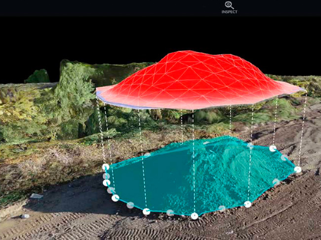
The Power of Aerial Views
In the past, construction teams relied on traditional methods and tools to assess their job sites. Whether it was physically visiting the site or relying on 2D maps, they never had the luxury of a high-resolution top-down view from above. However, with the advancements in drone technology, construction teams now have access to detailed aerial views that provide a level of visibility and insight like never before.
Unveiling Hidden Information
When we think about aerial views, we often imagine beautiful landscapes and stunning vistas. But in the construction industry, these views offer much more. They uncover a wealth of important data, metrics, and safety issues that were previously invisible or difficult to identify. By having these detailed aerial maps at their fingertips, construction teams can now spot problems and issues that may have gone unnoticed, leading to more efficient and safer job sites.
Cost and Time Savings
One of the most significant advantages of using detailed aerial maps in construction is the savings in both time and money. Traditionally, construction companies would have to physically visit their job sites regularly to monitor progress, assess challenges, and make informed decisions. This involved travel expenses, accommodation costs, and valuable time spent away from the office.
With high-resolution aerial maps, construction teams can remotely monitor their job sites without the need for constant travel. They can easily access images and maps, analyze the data, and make informed decisions from the comfort of their office. This eliminates the need for multiple plane tickets, hotel room bookings, and countless hours spent on the road. The savings in travel expenses alone can be substantial, allowing companies to allocate those funds to other areas of their projects.
Improved Safety and Risk Assessment
Safety is a top priority in the construction industry. Accidents and unforeseen hazards can result in costly delays, injuries, and even loss of life. With detailed aerial maps, construction teams gain an additional layer of safety and risk assessment.
By having a comprehensive view of the job site from above, potential safety issues can be identified and addressed proactively. This includes spotting potential hazards, ensuring strict compliance with safety regulations, and implementing necessary precautionary measures. By identifying and resolving these issues early on, construction companies can significantly reduce the risk of accidents and improve overall safety on their job sites.
Drone Brothers: The Game-Changing Aerial Mapping Service
If you’re intrigued by the possibilities that detailed aerial maps offer, look no further than Drone Brothers. As pioneers in the field of aerial mapping, we provide a game-changing service that has transformed the way construction teams monitor and manage their job sites across the country.
Drone Brothers’ mapping specialists are experts in capturing high-resolution aerial images and creating detailed maps that provide a comprehensive view of construction sites. By partnering with Drone Brothers, construction companies gain access to a wealth of valuable information and insights that can revolutionize their operations.
To fully grasp the transformative nature of this aerial mapping service, contact us today. We will arrange a demonstration, allowing you to experience firsthand the power and potential of detailed aerial maps. Witness how these maps can save your company money, improve efficiency, and enhance safety on your construction projects.
Conclusion
Detailed aerial maps created by drones are revolutionizing the construction industry. By providing a high-resolution top-down view of job sites, these maps save companies significant amounts of money on travel expenses while offering valuable insights into operations, metrics, and safety issues. The power of aerial views combined with the cost and time savings make this technology a game-changer for construction teams.
Don’t miss out on the opportunity to take your construction projects to new heights. Contact Drone Brothers today and embark on a journey towards more efficient and safer job sites. With their expertise and innovative aerial mapping service, you’ll gain a competitive edge in the industry while reaping the benefits of this transformative technology.

0 Comments