Your Best Defense Against Disputes Is a Timestamped Aerial Record.
Construction disputes are expensive, time-consuming, and almost always hinge on one question: what was actually built, and when? Systematic drone documentation answers that question with irrefutable, georeferenced, timestamped evidence, before a dispute ever reaches arbitration.
Executive Summary
The Question Every Dispute Comes Down To
Construction disputes are expensive, time-consuming, and almost always hinge on the same question: what was actually built, and when? The answer to that question — or the inability to answer it precisely — determines the outcome of more claims, arbitrations, and owner disagreements than any other single factor.
According to the Arcadis Global Construction Disputes Report (2025), the average value of a construction dispute in North America reached $54.7 million, with an average resolution time of 14.7 months. Legal and expert fees alone routinely consume 10–15% of the disputed contract value — before any settlement is reached. And in the majority of cases, the party with the most comprehensive contemporaneous documentation of site conditions wins.
This case study examines how systematic drone documentation of structural progress — georeferenced, timestamped, and organized in a searchable archive — is changing the risk profile of commercial construction projects, and why the aerial record is becoming as essential to project controls as the schedule or the budget.
$54.7MAverage Dispute ValueAverage value of a North American construction dispute in 2025 (Arcadis Global Disputes Report, 2025)14.7 MoAverage Resolution TimeAverage time to resolve a construction dispute in North America — nearly 15 months of management distraction (Arcadis, 2025)10–15%Legal Cost BurdenLegal and expert fees as a share of disputed contract value — before any settlement is reached (Arcadis, 2025)
The Documentation Gap
Why Construction Disputes Are So Hard to Resolve
The root cause of most construction disputes is not bad faith. It is the absence of an objective, contemporaneous record of what happened and when. Without a definitive record, resolution requires expert witnesses, forensic schedule analysis, and months of legal process to establish facts that could have been documented in minutes with an aerial flight.
The American Institute of Architects reports that construction litigation has increased 23% since 2020, driven in part by the increasing complexity of owner agreements, tighter milestone payment structures, and more aggressive contract enforcement by owners whose own lenders require project performance documentation.
The KPMG Global Construction Survey (2024) found that 45% of project disputes could have been avoided or significantly shortened if better contemporaneous documentation had been maintained. Among projects with systematic aerial documentation programs, that rate drops significantly, because the record speaks for itself.
Most Common Dispute Triggers
- Owner disputes over milestone payment certification. Arcadis Global Disputes Report, 2025
- Subcontractor claims of early completion before inspection. AIA Construction Litigation Report, 2025
- Differing site conditions vs. original survey baseline. Construction Management Association, 2024
- Insurance events requiring pre-existing condition proof. Zurich Construction Risk Report, 2024
- Change order disputes over scope and timing. Arcadis, 2025
- Delay claims with disputed responsibility attribution. KPMG Global Construction Survey, 2024
The Aerial Documentation Advantage
What a Systematic Drone Record Provides
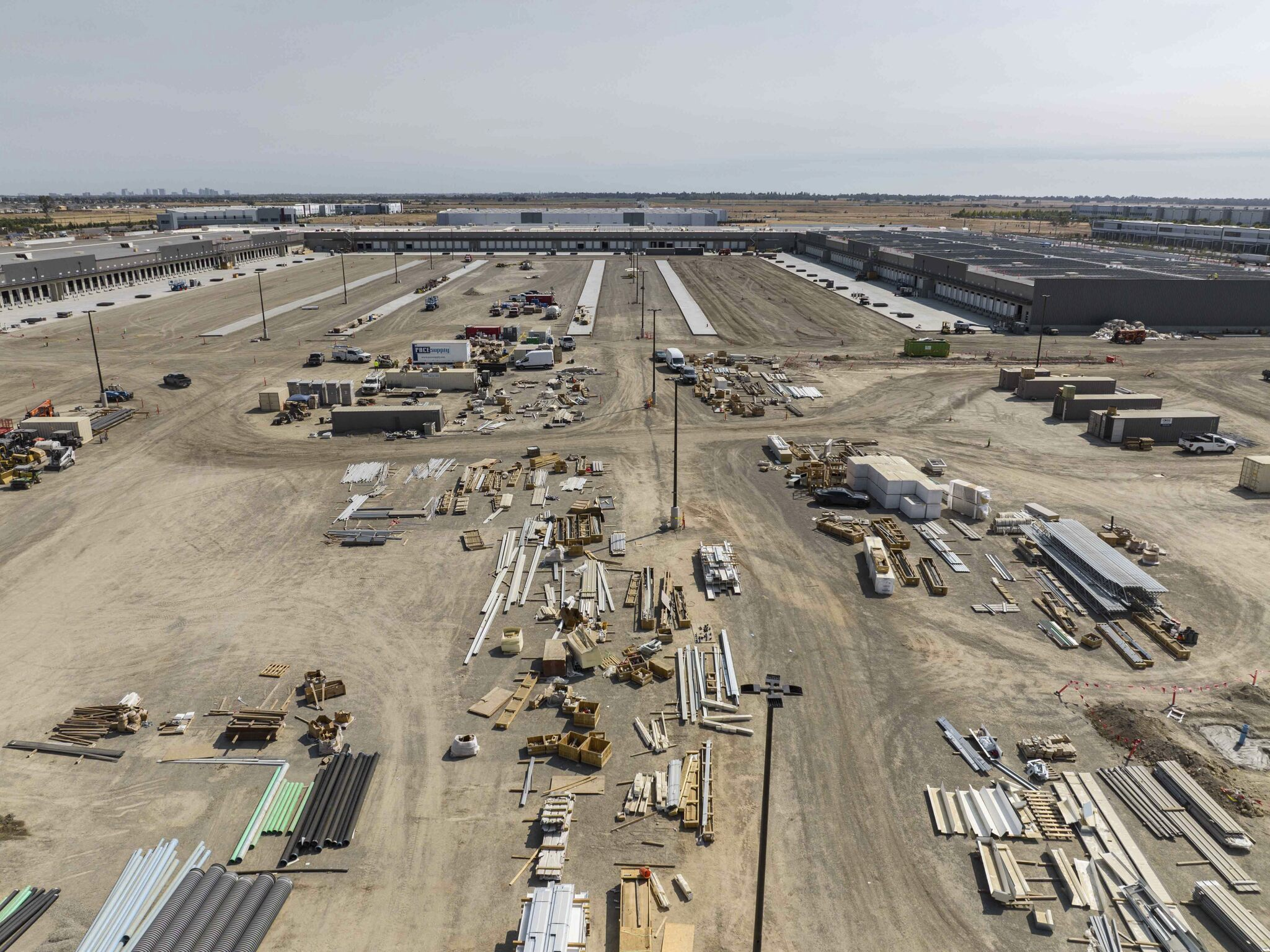
Systematic drone documentation of structural progress creates a georeferenced, timestamped visual record of the project at every stage of vertical construction. Concrete placement, steel erection, façade installation, roof progress. Each captured with spatial accuracy and organized in a searchable ONE CLICK archive. The value of this record operates across four distinct risk scenarios.
01
Subcontractor completion claims and milestone disputes
When a subcontractor claims work was complete before an inspection date, the aerial record provides an objective, third-party visual baseline that neither party can reasonably dispute. A georeferenced overhead image of the floor in question, dated and timestamped, showing the actual state of installation at the relevant date, is more persuasive than any verbal account or project diary entry. On projects using the DSP+™ program, subcontractor completion disputes have been resolved in days rather than months, because the documentation eliminates the factual ambiguity that fuels prolonged negotiation.
02
Owner milestone payment and progress certification disputes
As owner agreements become more sophisticated and milestone payment structures more precisely defined, the risk of payment disputes increases proportionally. A comprehensive aerial documentation archive, showing the project’s physical state at every milestone date, provides the independent visual evidence that supports certification and accelerates draw release. JLL’s Construction Finance Report (2025) found that projects with structured aerial documentation programs experience 28% fewer payment disputes and 18% faster draw processing than industry averages.
03
Insurance events and pre-existing condition documentation
When a weather event, fire, flood, or third-party incident affects a construction site, the insurance claim process immediately requires documentation of pre-existing site conditions. The Zurich Construction Risk Report (2024) found that claims with comprehensive pre-event site documentation are settled on average 40% faster and at 15–20% higher recovery rates than those without. The aerial record is not just a scheduling tool, it’s insurance documentation that begins on day one.
04
Delay claim attribution and forensic schedule analysis
Delay claims are among the most contested and expensive categories of construction dispute. A comprehensive aerial documentation program provides the most reliable input available for forensic schedule analysis. A visual record of actual site conditions, updated on a regular cadence, that allows analysts to correlate physical progress with scheduled activities and identify the spatial and temporal origin of delay events with a precision that no other documentation method can match.
Strategic Implications
From Reactive Defense to Proactive Protection
The shift from ad hoc documentation to a systematic aerial program changes a project team’s legal and financial risk profile across the entire project lifecycle.
| Dispute Scenario | Without Aerial Documentation | With Systematic Aerial Record |
|---|---|---|
| Subcontractor completion claim | Disputed verbal accounts, months of negotiation or arbitration required | Timestamped aerial image resolves factual question within days |
| Owner milestone payment dispute | GC certification insufficient without independent verification = draw delayed | Aerial archive supports certification independently = faster draw release |
| Insurance event claim | Pre-existing conditions difficult to establish = slower settlement, lower recovery | Pre-event aerial record enables faster settlement at higher recovery rate |
| Delay claim attribution | Forensic analysis relies on incomplete records = contested and expensive | Aerial progress record provides reliable baseline for forensic analysis |
| Change order scope dispute | Pre-change condition undocumented = scope of impact contested | Pre-change aerial baseline establishes existing conditions objectively |
The DSP+™ Perspective
Documentation as a Project Controls Discipline
For project managers and superintendents managing projects under complex owner agreements, the aerial documentation program is as important as any schedule or budget tool in the project controls arsenal. That is not a marketing claim. It is a reflection of how the legal and financial risk landscape of commercial construction has changed.
The DSP+™ model delivers documentation that is not just visually compelling but legally defensible, georeferenced to within centimeters, timestamped with metadata that establishes the date and time of capture, organized in a searchable archive accessible to project teams, owners, and legal counsel, and delivered through the DroneDeploy Enterprise platform in formats compatible with construction management systems and legal discovery requirements.
Several of the nation’s largest general contractors have begun requiring aerial documentation programs as a standard component of their project controls protocols. Not because it is required by contract, but because the risk of operating without it has become too significant to ignore.
DSP+™ Documentation Capabilities
- Georeferenced imagery accurate to within centimeters, Delivered via DroneDeploy Enterprise
- Full metadata timestamping on every capture, Legally defensible date/time record
- Searchable archive organized by project phase, Accessible to legal, owner, and field teams
- Pre/post event documentation flights on request, Weather, incidents, and milestone events
- Progress-vs-plan comparison at every milestone, Visual certification support
- Compatible with legal discovery requirements, Standard export formats supported
Construction disputes will always exist. But projects with a comprehensive aerial documentation program enter those disputes from a fundamentally different position. With an irrefutable, georeferenced, timestamped record of what was built and when. That record resolves factual questions quickly, supports milestone certifications independently, accelerates insurance settlements, and provides forensic analysts with the most reliable input available. The aerial documentation program is not overhead. It is risk management infrastructure that pays for itself the first time it is needed.
Primary source: Arcadis Global Construction Disputes Report (2025)
Additional sources: AIA Construction Litigation Report (2025) · KPMG Global Construction Survey (2024) · JLL Construction Finance Report (2025) · Zurich Construction Risk Report (2024) · Construction Management Association of America (2024)
© 2026 Drone Brothers. All rights reserved. DSP+™ is a trademark of Drone Brothers.