
Drones offer a number of advantages over traditional surveyors, particularly in the context of efficiency, cost-effectiveness, and data accuracy. Here are 10 ways drones are better than surveyors for tasks like mapping and surveying:
- Faster Data Collection: Drones can cover large areas quickly, capturing vast amounts of data in a fraction of the time it would take traditional surveyors to do the same job. This significantly speeds up project timelines.
- Access to Hard-to-Reach Areas: Drones can easily access difficult or dangerous locations, such as steep terrains, cliffs, or hazardous sites, where surveyors would otherwise need specialized equipment or could face safety risks.
- Cost-Effective: Drones reduce the need for expensive equipment (e.g., cranes, helicopters) and large crews, cutting overall survey costs. The technology required for drone surveys is also more affordable than traditional surveying methods.
- High-Resolution Imagery: Drones capture high-resolution aerial imagery, allowing for extremely detailed data that can be used for precise mapping and analysis. This level of detail might be difficult or time-consuming for surveyors to capture manually.
- Real-Time Data: Drones can provide real-time data during surveys, enabling project managers to make immediate decisions. Traditional surveys may take days or even weeks to process and analyze.
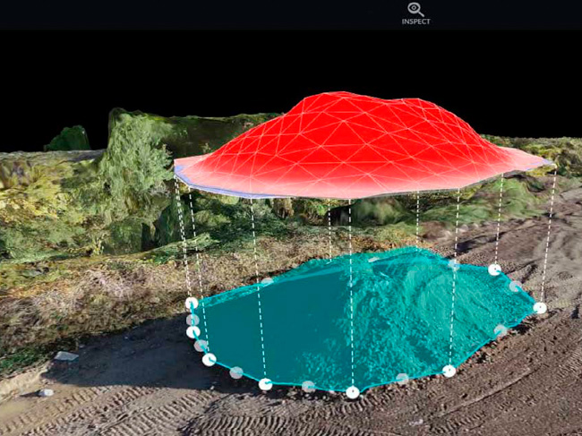
- 3D Modeling and Mapping: Drones can generate 3D models and digital elevation models (DEMs) directly from their aerial imagery using photogrammetry software. These models are much more detailed and accurate than the traditional 2D maps produced by surveyors.
- Reduced Safety Risks: Drones can survey hazardous or unsafe environments—such as construction sites, power lines, or disaster areas—without putting human surveyors at risk. This reduces accidents and enhances safety.
- Higher Accuracy in Data: Drones equipped with GPS and photogrammetry technology can capture highly accurate data, even down to centimeter-level precision. While traditional surveyors are also highly accurate, drones can achieve this level of precision in a fraction of the time.
- Less Labor-Intensive: Traditional surveying often requires teams of people and extensive physical labor to gather data. Drones reduce the amount of manual labor required, allowing a single operator to manage the entire process.
- Easier Monitoring and Progress Tracking: Drones allow for easy and frequent updates on a project’s progress, as they can be flown multiple times during the course of a project to track changes. Surveyors, on the other hand, often only survey at specific intervals, which can make it harder to monitor ongoing work.
In summary, drones provide faster, safer, and more cost-effective surveying solutions with highly accurate data and the ability to access challenging locations, making them a superior choice for many modern surveying tasks.

0 Comments